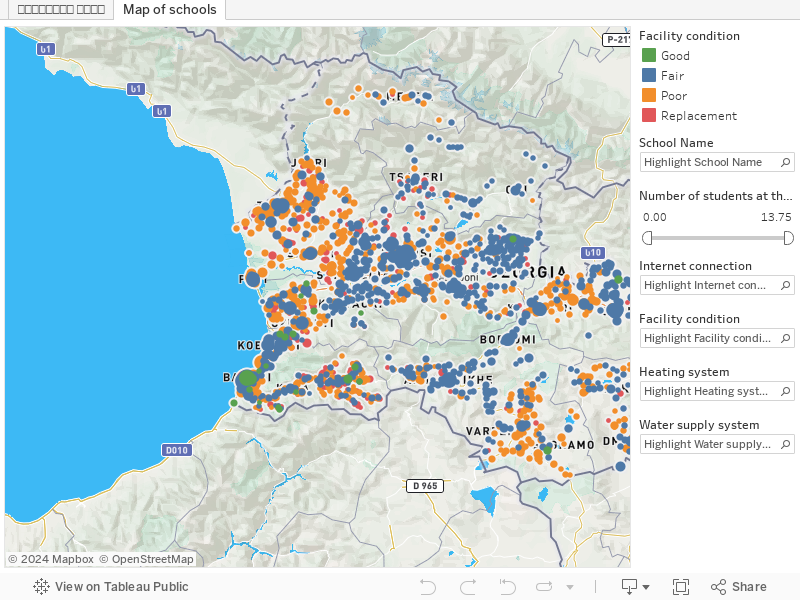
The information provided on the public school infrastructure map is based on the public school infrastructure data collected by the Millenium Challenge Account Georgia in 2018-2019 and provided to GeoWel by the Education and Science Infrastructure Development Agency (ESIDA) in 2019. The interactive map was developed by Zaxis for GeoWel in frame of GeoWel’s Education Advocacy Project implemented in 2020-2021 with the financial aid of the US Embassy in Georgia. The infrastructure data was scraped from 2,233 individual school files provided by ESIDA and compiled in a single database linked to the map.
GeoWel encourages education policymakers, scientists, researchers, school management and other stakeholders to use and refer to the interactive map for their research purposes.
Note: Enumerator error is expected. Therefore, in case of any inconsistency of the data provided on the map, contact us.